by Nick | Jun 5, 2019 | Maps
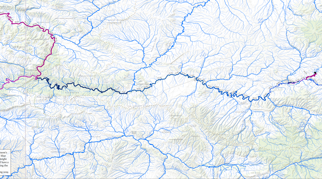
Yampa-Green-River Flow RegulationThe full 50 inch wide print layout, designed to be used in presentations that zoom in on specific locations Yampa Green Flow Regulation 8 1/2 x 11 Print LayoutA figure adapted for 8 1/2 x 11 printing and use in papers and reports For a...
by Nick | Feb 2, 2017 | Code
I write a lot of spatial data analysis code using ArcGIS’s Python package, arcpy. Sometimes we need to automate map generation as part of that work, but with the split of the arcpy.mapping library between ArcMap and ArcGIS Pro, developers had to target two...
by Nick | Jan 14, 2017 | Maps, Projects, Teaching
I receive a number of requests for additional instruction from former students who have taken one class or another. I decided to combine my tutorials for water and ecosystem analysis in ArcGIS into a single book on LeanPub, which allows for work in progress...
by Nick | Dec 30, 2016 | Maps
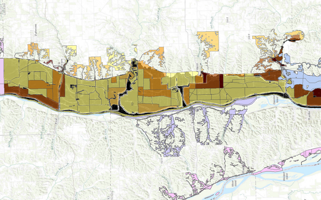
I led a team of people using FEMA’s Hazus-MH (Multi-Hazard) software to model flood risk to 2 dozen Illinois communities as part of a larger project to measure perceived vs actual risk of flood in those communities. Hazus can be finicky software, so we tried...
by Nick | Apr 17, 2015 | Blog, Technical
This week, I needed to convert a number of polygon feature classes to raster. Some of these feature classes included large numbers of features that were small relative to the cell size of the raster. Because of this, they wouldn’t get captured at all in the...
