by Nick | Jan 14, 2017 | Maps, Projects, Teaching
I receive a number of requests for additional instruction from former students who have taken one class or another. I decided to combine my tutorials for water and ecosystem analysis in ArcGIS into a single book on LeanPub, which allows for work in progress...
by Nick | Dec 30, 2016 | Maps
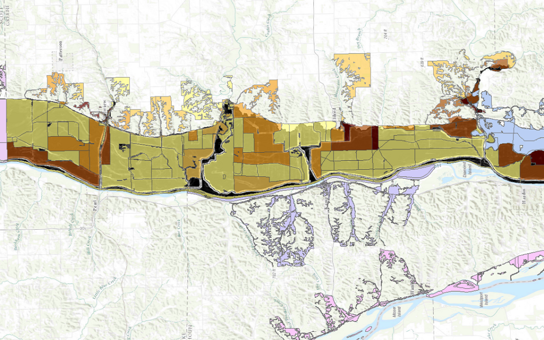
I led a team of people using FEMA’s Hazus-MH (Multi-Hazard) software to model flood risk to 2 dozen Illinois communities as part of a larger project to measure perceived vs actual risk of flood in those communities. Hazus can be finicky software, so we tried...
by Nick | Aug 19, 2016 | Maps
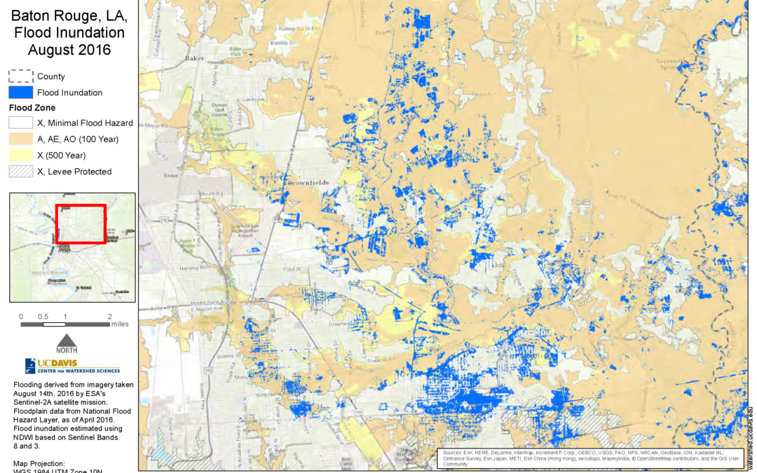
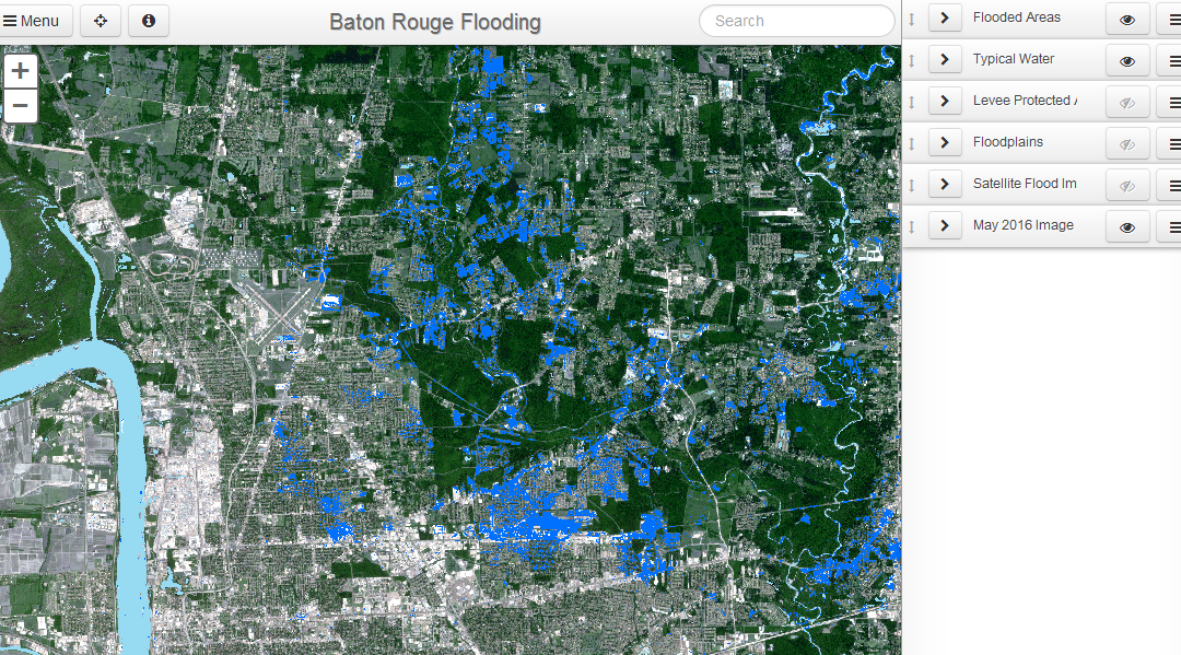
I created this static map as part of Nicholas Pinter’s Natural Hazards Mitigation Group’s analysis of flood inundation in the 2016 flooding in Baton Rouge, Louisiana. The corresponding interactive map can be found here.
by Nick | Aug 19, 2016 | Maps
In response to flooding in Baton Rouge, Louisiana as a result of storms in August 2016, we detected flooding using satellite imagery to determine the extent of inundation as it compared to mapped floodplains. The darker blue shows flood inundation on Aug. 14, 2016,...
by Nick | Nov 30, 2015 | Maps
For this project, I guided a first time web mapper in how to present the data visually and how to implement that presentation in code. The map uses Leaflet and D3 to provide interactive visualization of California economic data on agriculture at multiple spatial...
