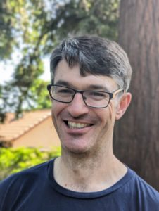
Nick Santos is a programmer, GIS specialist, instructor, web developer, and environmentalist specializing in decision support applications. Nick works at the Center for Information Technology Research in the Interest of Society (CITRIS) at the University of California, Merced where he develops models, software, databases, and applications to help analyze and understand California agriculture as well as environmental impacts and indicators. He is an administrator of The Spatial Community, an open Slack community for spatial professionals of all types to solve problems, share knowledge, and socialize. In the recent past, he worked at the Center for Watershed Sciences at the University of California, Davis, taught GIS in classes and as the instructor for Coursera‘s 5 course specialization in GIS, and supported the University of Oregon’s McMurdo Oceanographic Observatory in Antarctica. He was the founder and Executive Director of Environmental Consumer, a 501(c)(3) nonprofit that developed actionable information and resources for consumers looking to take the next step to reduce their impact. He has held fellowships for research with the UC Davis Institute for the Environment, science communication with COMPASS, and climate change action with Roosevelt Institute: Pipeline. In the past he has worked with the UC Sustainable Agriculture Research and Education Program (SAREP), as a Policy Fellow at climate campaign 1Sky (now merged with 350.org), and as an member of the Regional Climate Change Program at the Sierra Nevada Alliance.
Research Interests
- Automated extraction and processing of geographically-based parameters for use in applications and research.
- Data models, databases, and applications for environmental decision support.
- Remote sensing, collection, and transmission networks for environmental monitoring.
- Information systems for changing consumer behavior.
Elsewhere on the Web

Coding
Professional
Affiliations
Current:
- UC Merced Water Systems Management Lab
- UC Merced Center for Information Technology Research in the Interest of Society (UCM CITRIS)
Former:
- UC Davis Continuing and Professional Education (Instructor)
- Coursera (Instructor)
- UC Davis Center for Watershed Sciences
- McMurdo Oceanographic Observatory
- Environmental Consumer
- Applied Technology and Sciences (ATS)
- Sierra Nevada Alliance
- 1Sky (now part of 350.org)
- UC Sustainable Agriculture Research and Education Program (SAREP)
