
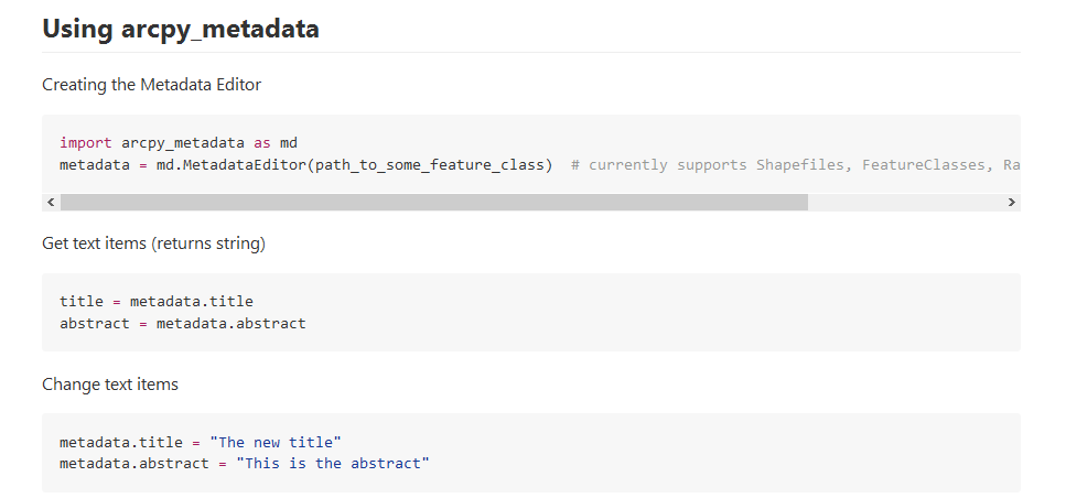
ArcGIS provides powerful geoprocessing and data manipulation tools in Python, but provides no programmatic access to metadata from the language, meaning that once data is processed, information on the workflow used can’t be attached to the results. To remedy this so that code that produces large numbers of resulting spatial data can attach metadata, I wrote arcpy_metadata, a Pythonic package that provides access to metadata as an object. The initial code has since been extended significantly by others on GitHub to support a wider variety of metadata fields. It can be downloaded from GitHub (below) or installed via pip.