MODIS Imagery Bookmarklets

A few years ago, I wrote some bookmarklets for quickly viewing recent MODIS satellite images - I've now moved their hosting here Just drag the links below into your bookmarks or onto your bookmarks bar to save them. Then click them to access the appropriate imagery....
Hurricane Harvey Flooding Extent

Hurricane Harvey Flooding Extent

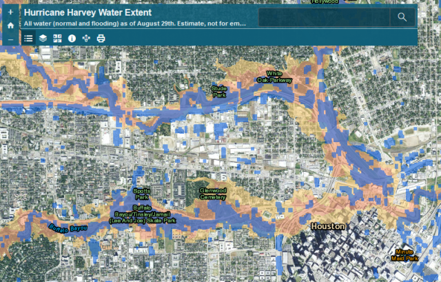
After Hurricane Harvey hit, the Natural Hazards Research Group wanted to assess the extent of the flooding as it related to mapped floodplains, as part of ongoing research into flood insurance and hazard mitigation nationwide to inform the National Flood Insurance...