by Nick | Sep 1, 2017 | Maps
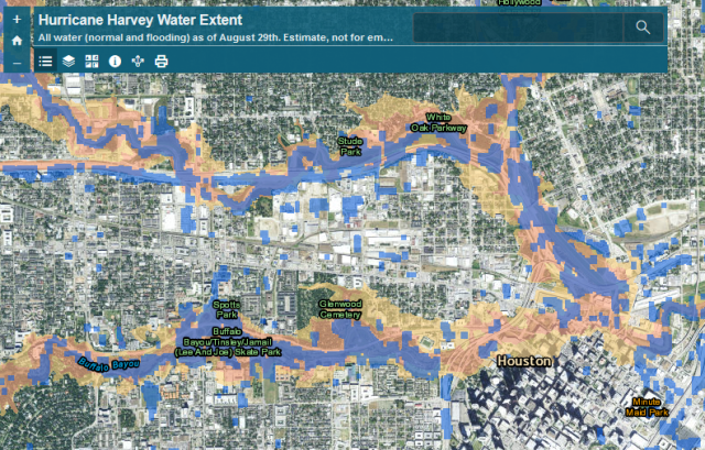
After Hurricane Harvey hit, the Natural Hazards Research Group wanted to assess the extent of the flooding as it related to mapped floodplains, as part of ongoing research into flood insurance and hazard mitigation nationwide to inform the National Flood Insurance...
by Nick | Jan 14, 2017 | Maps, Projects, Teaching
I receive a number of requests for additional instruction from former students who have taken one class or another. I decided to combine my tutorials for water and ecosystem analysis in ArcGIS into a single book on LeanPub, which allows for work in progress...
by Nick | Jan 14, 2017 | Projects, Technical
In December 2016, after the Trump administration was elected, but before they took office, I helped start a group of volunteers working to protect climate data from deletion or tampering under the Trump Administration. While it seemed impossible to think they could...
by Nick | Jul 14, 2014 | Technical
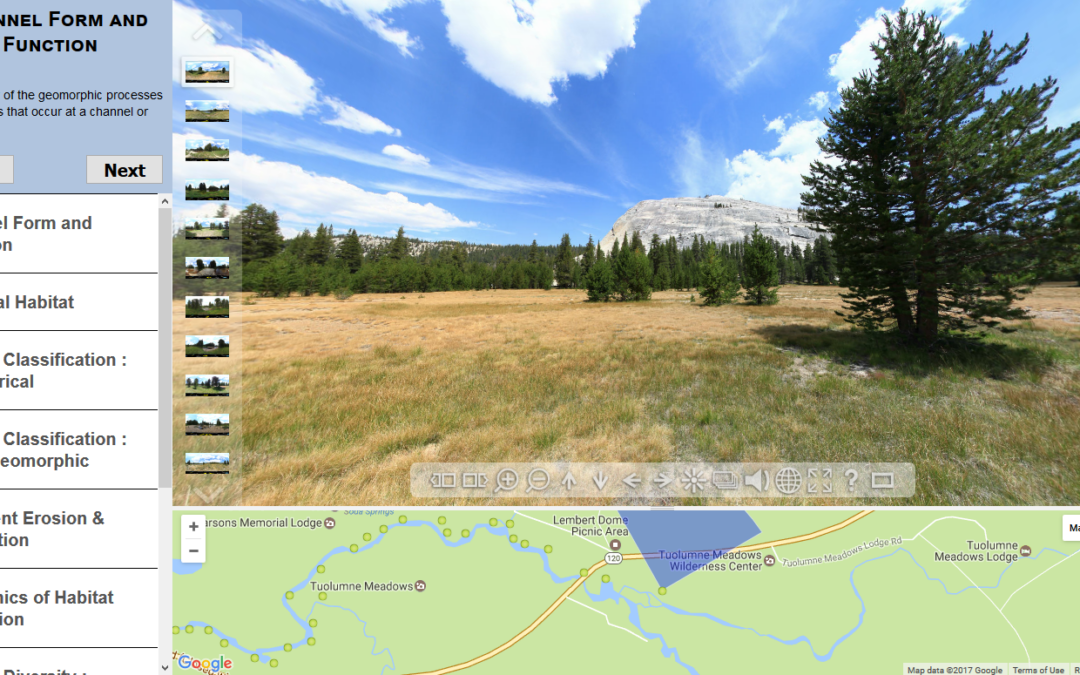
As part of a class where students gained extensive experience in the field, my colleague Sarah Yarnell led a team of researchers at the Center for Watershed Sciences that developed a virtual field trip as a pre-field trip teaching tool, and a way to expose the public...
