by Nick | Sep 1, 2017 | Maps
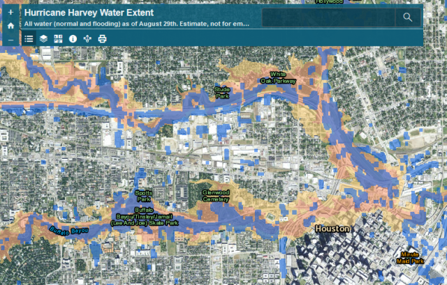
After Hurricane Harvey hit, the Natural Hazards Research Group wanted to assess the extent of the flooding as it related to mapped floodplains, as part of ongoing research into flood insurance and hazard mitigation nationwide to inform the National Flood Insurance...
by Nick | Jan 14, 2017 | Projects, Technical
In December 2016, after the Trump administration was elected, but before they took office, I helped start a group of volunteers working to protect climate data from deletion or tampering under the Trump Administration. While it seemed impossible to think they could...
by Nick | Jul 29, 2016 | Code, Maps, Technical
I did all of the programming, GIS, and statistical modelling for a multi-phase National Science Foundation (NSF) funded project to determine mitigation potential for flooding in small midwestern towns. The picture above is from a mockup of an interface we designed to...
by Nick | Nov 30, 2015 | Maps
For this project, I guided a first time web mapper in how to present the data visually and how to implement that presentation in code. The map uses Leaflet and D3 to provide interactive visualization of California economic data on agriculture at multiple spatial...
by Nick | Oct 11, 2015 | Maps
I built a web map viewer for the PISCES California fish species range data. The data is served by ArcGIS Server and the viewer is a mix of a coworker’s custom map viewer that uses the ArcGIS API and site-specific javascript coded by me. Launch the Map...
