
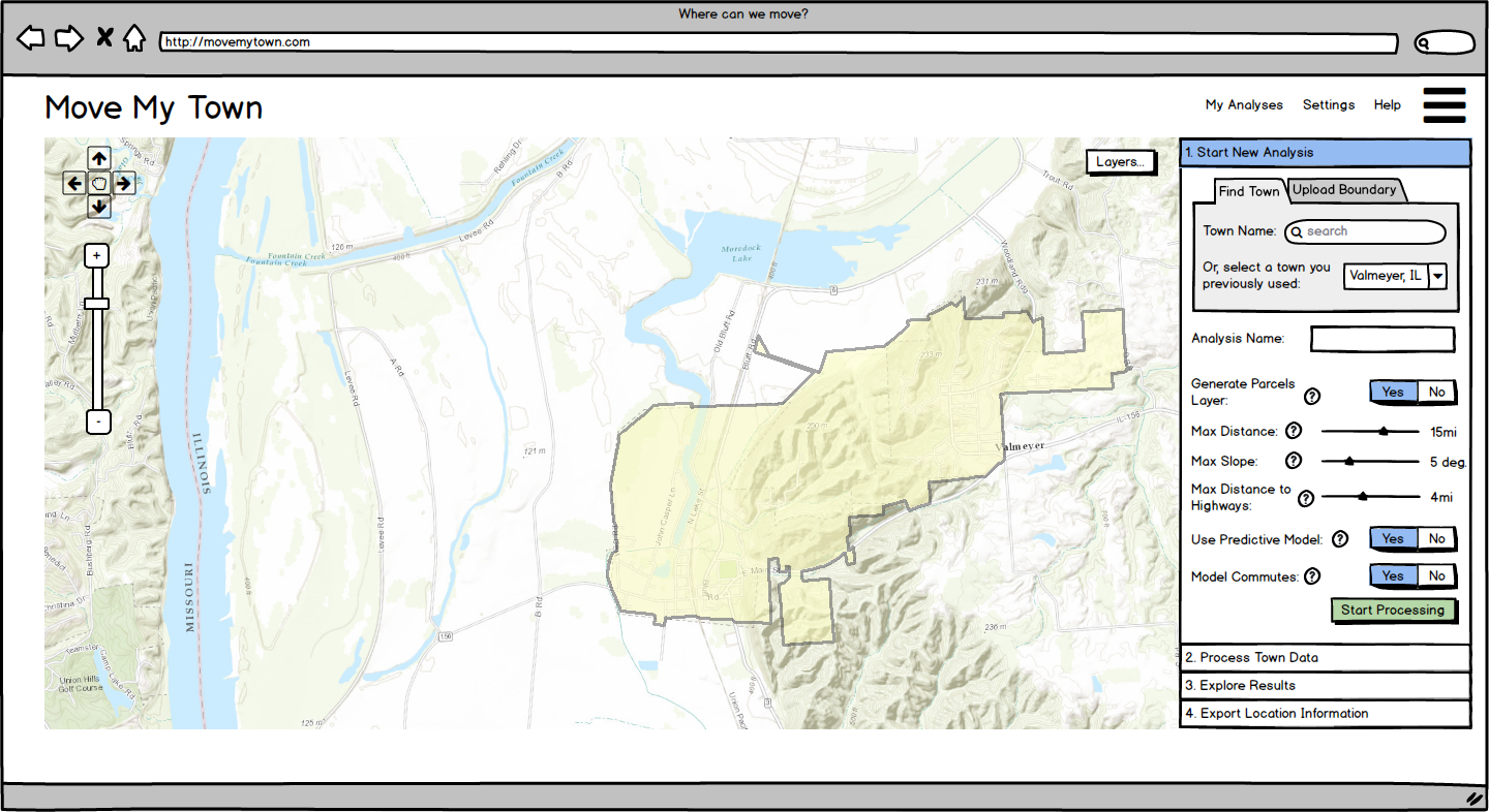
I did all of the programming, GIS, and statistical modelling for a multi-phase National Science Foundation (NSF) funded project to determine mitigation potential for flooding in small midwestern towns. The picture above is from a mockup of an interface we designed to allow town governments to use our tool to find suitable locations, out of harms way, to relocate their town.
While this project wasn’t funded to be a web tool or decision support system, I built it into a Django-framework based web application to allow for easy future expansion of the project into this potential use. It includes two primary components – one that allows arbitrary chaining of typical GIS-based suitability analysis tasks to narrow in on suitable sites and another, more important component: a calibrated statistical model that uses 11 towns that previously relocated out of floodplains to determine what characteristics are important in new town locations. The statistical model uses a random forests classifier built using Python’s scikit-learn package.