
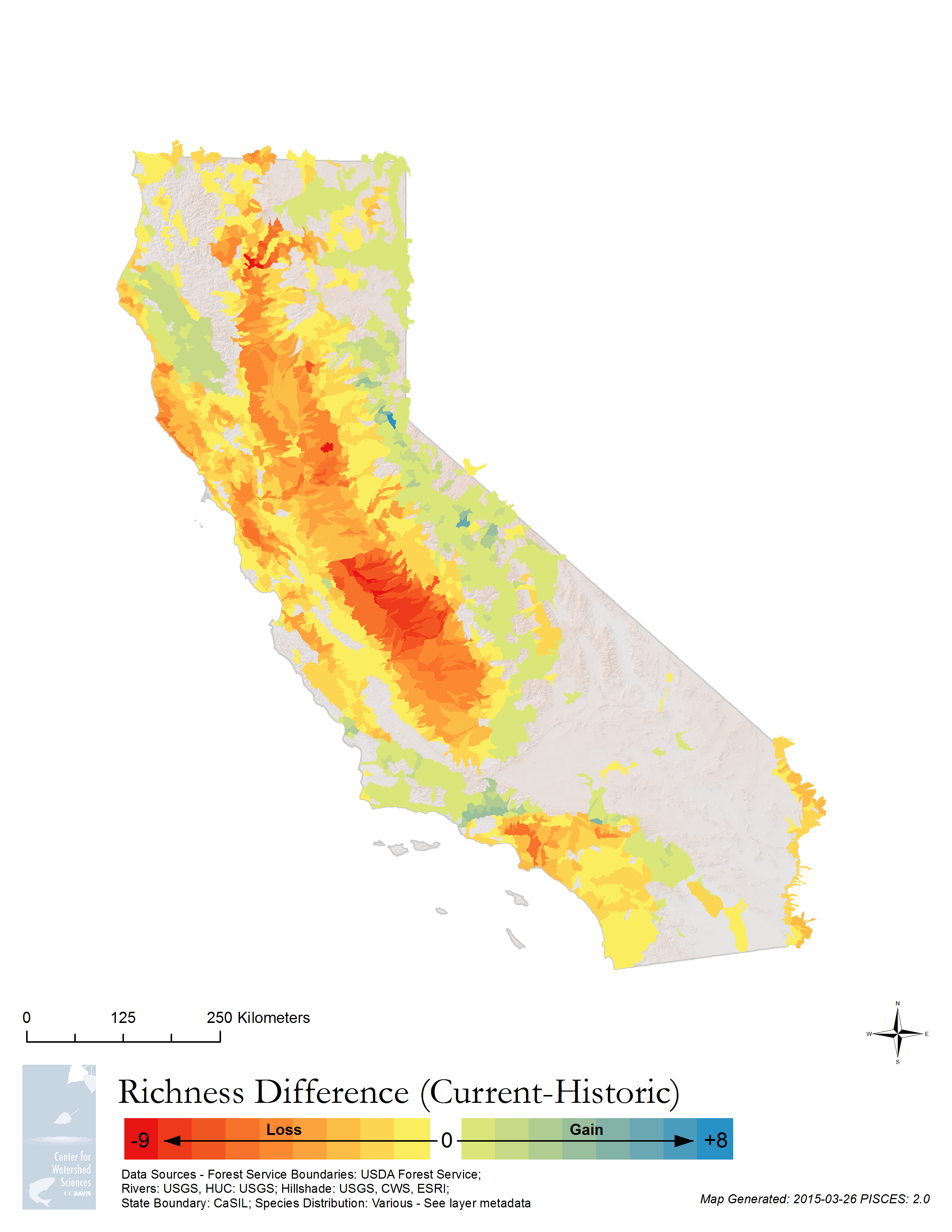
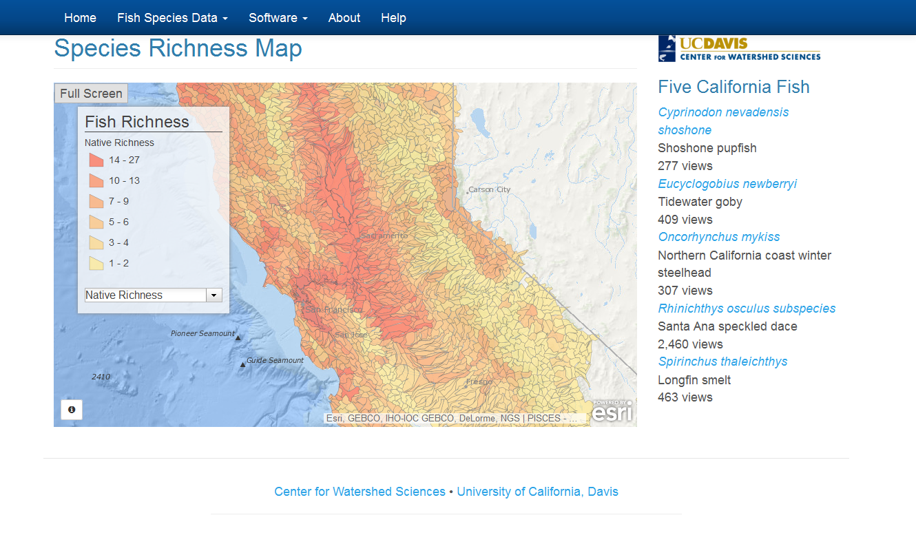
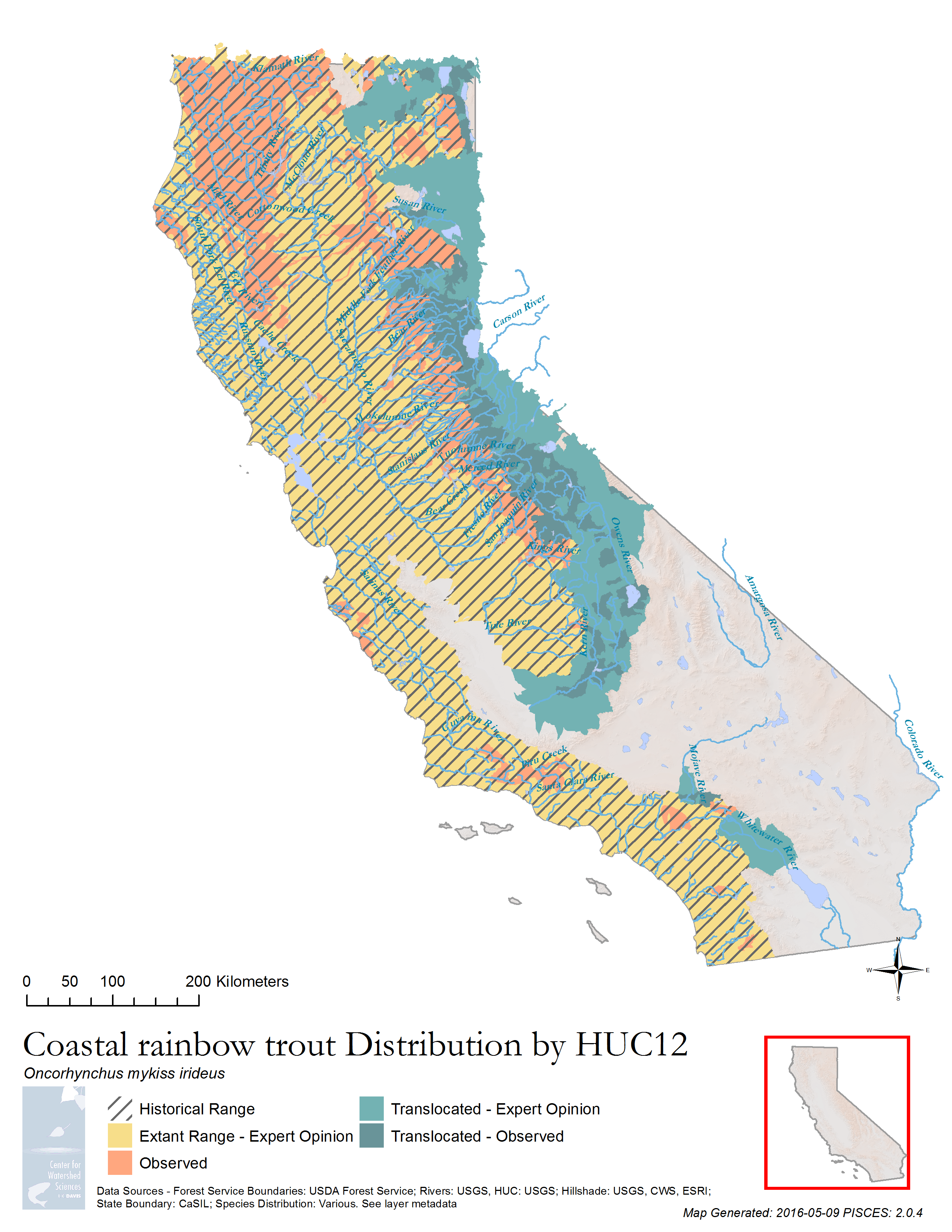


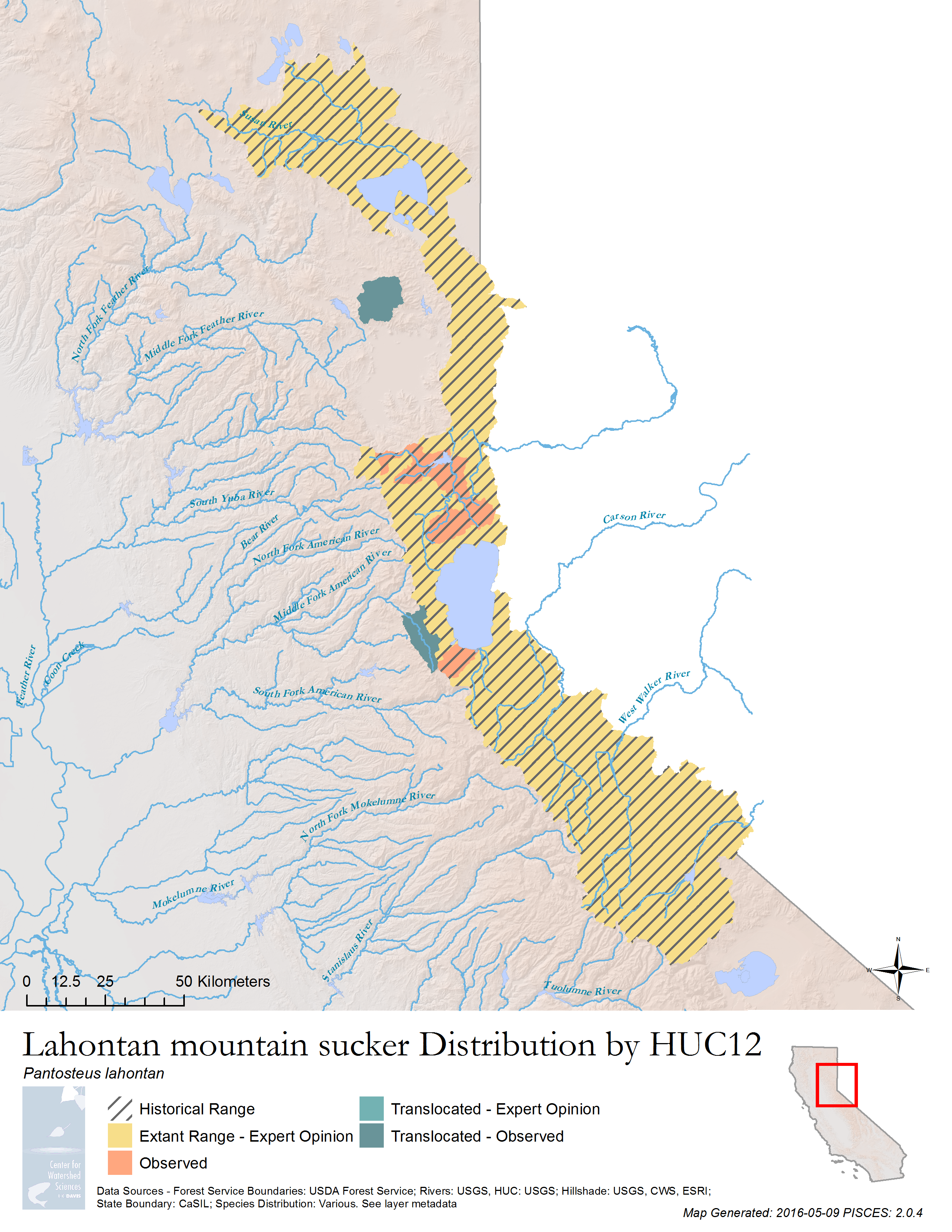

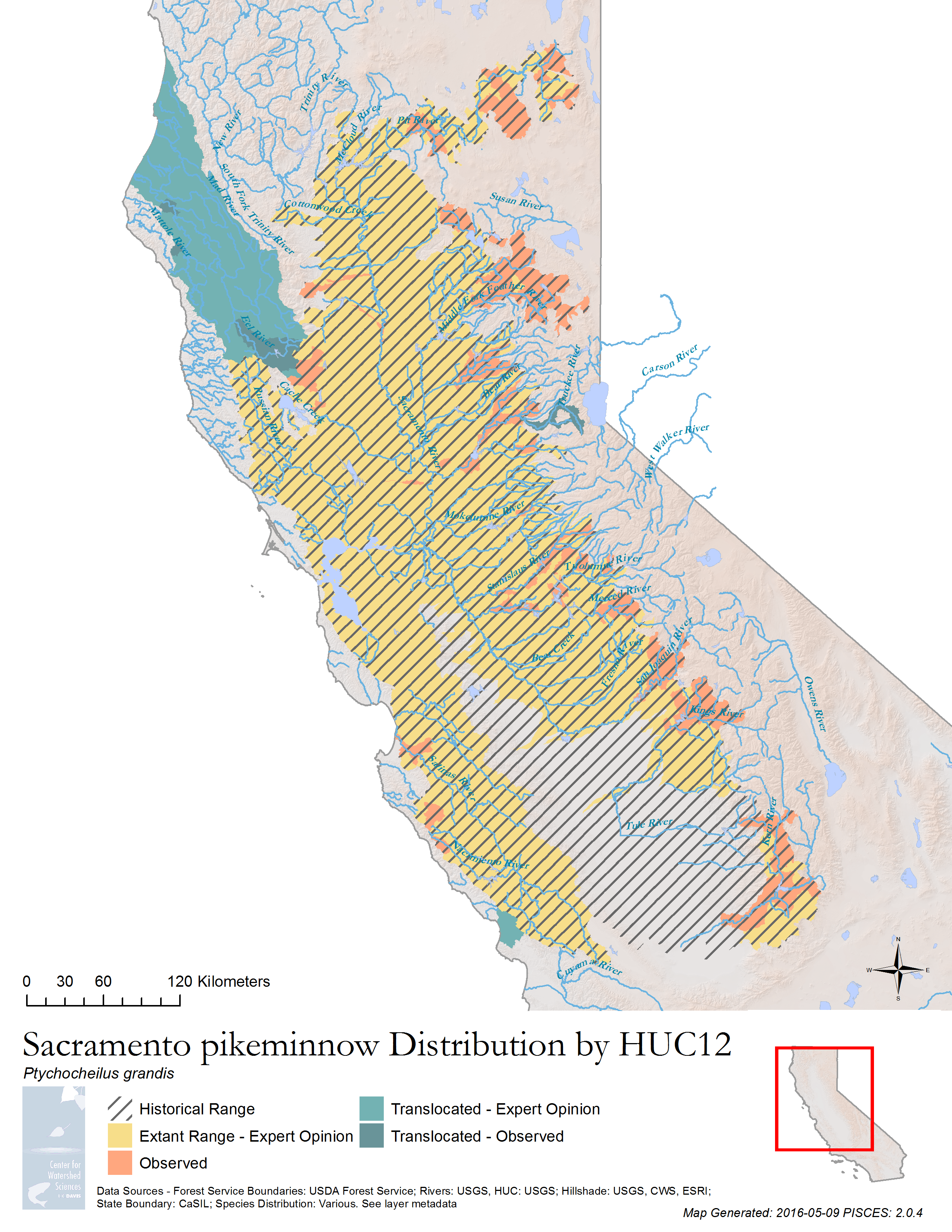
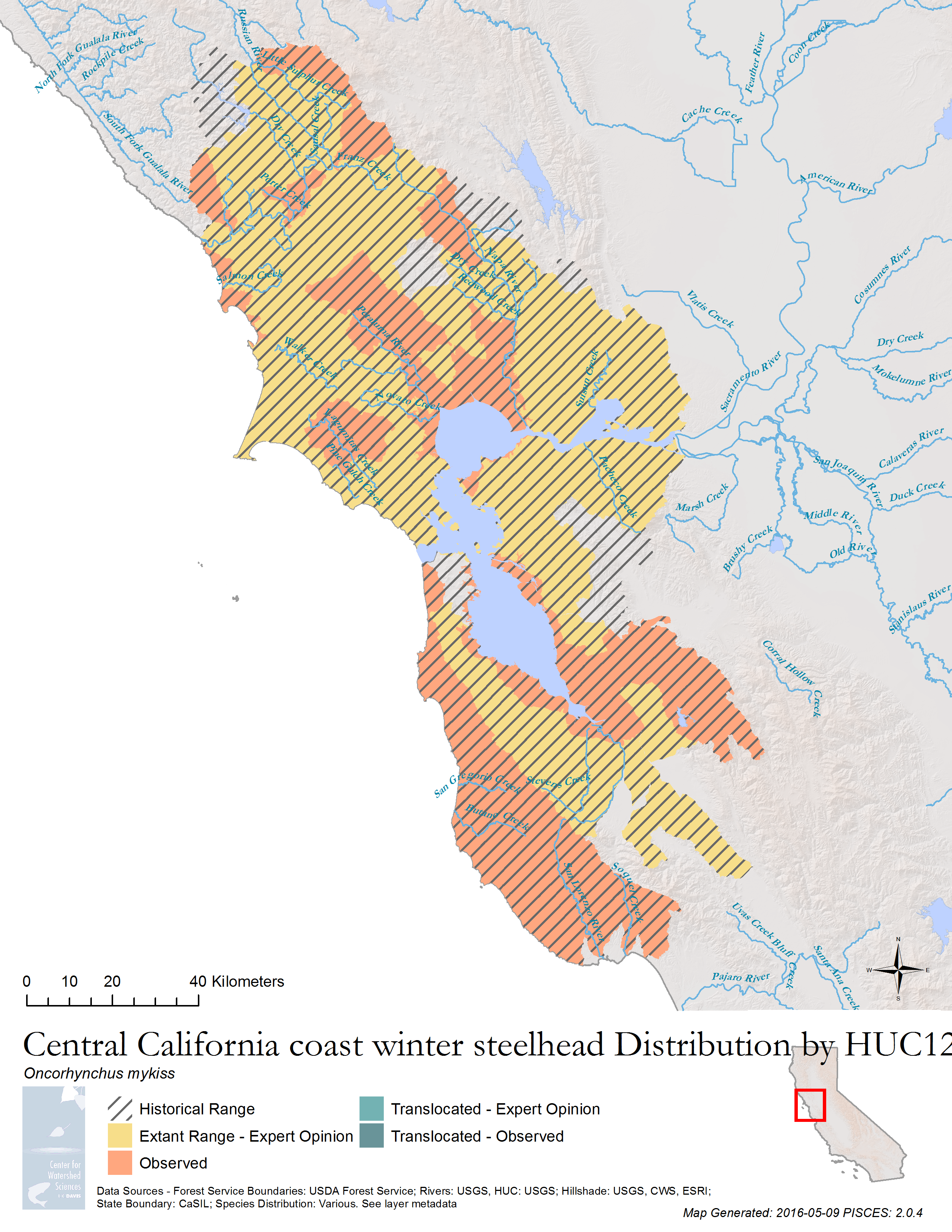
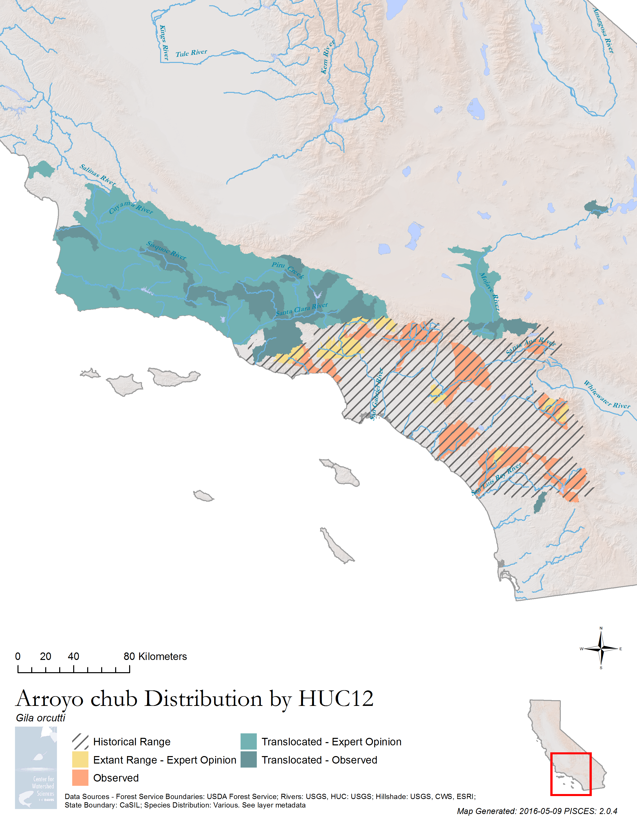
PISCES is a set of ArcGIS tools and data for managing and analyzing the ranges of California’s 133 native fish taxa. Data is stored as a standard relational database, increasing the power over many typical GIS approaches, and allowing for a powerful mapping component that summarizes species presence information on the basis of factors such as sensitivity to stressors, changes in range, genus, and more. The map engine allows for configuring a map’s layers as SQL queries once, and having it run for many species, resulting in many of the maps you see above.
The software is coded entirely in Python and uses arcpy to interface with ArcGIS for spatial analysis. The relational database backend is a Spatialite database, to keep the database portable, with additional spatial data kept in Esri file geodatabases. The software installs with a standard Windows installer and provides an ArcGIS toolbox, a command line utility, and database access for additional configuration.