

Yampa-Green-River Flow Regulation
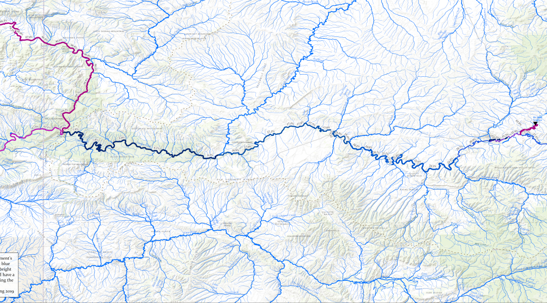
The full 50 inch wide print layout, designed to be used in presentations that zoom in on specific locations
Yampa Green Flow Regulation 8 1/2 x 11 Print Layout
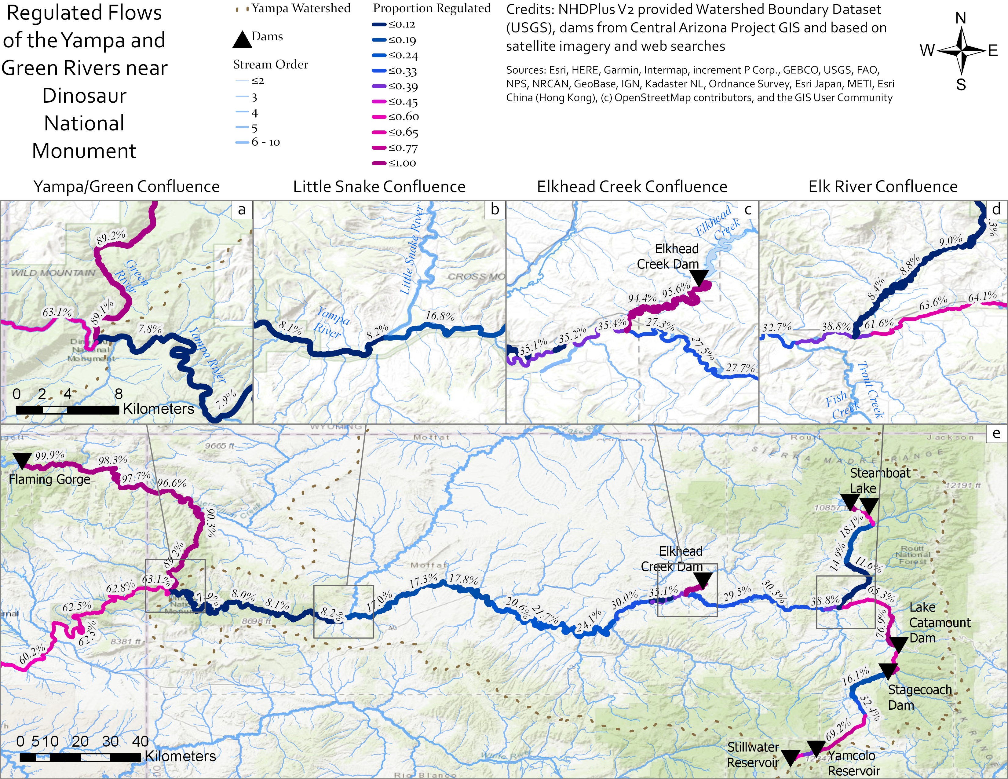
A figure adapted for 8 1/2 x 11 printing and use in papers and reports
For a grad class, I assessed flow regulation on the Yampa River in western Colorado and the adjoining segments of the Green River in Colorado and eastern Utah. I used a database of dams in the region from the Central Arizona Project and identified other impoundments with imagery and verified via Internet searches. From there, I used the NHDPlus data on catchment size of each stream segment to identify the portion of each stream reach that was impounded using simple Python calculations.
The maps were created in ArcGIS Pro. The small-scale large-format map was used for a presentation where I zoomed to detail areas and the standard size map with the insets for publication. Both were made in ArcGIS Pro.
The full-size 50 inch PDF can be found here.