by Nick | Jan 14, 2017 | Projects, Technical
In December 2016, after the Trump administration was elected, but before they took office, I helped start a group of volunteers working to protect climate data from deletion or tampering under the Trump Administration. While it seemed impossible to think they could...
by Nick | Dec 30, 2016 | Maps
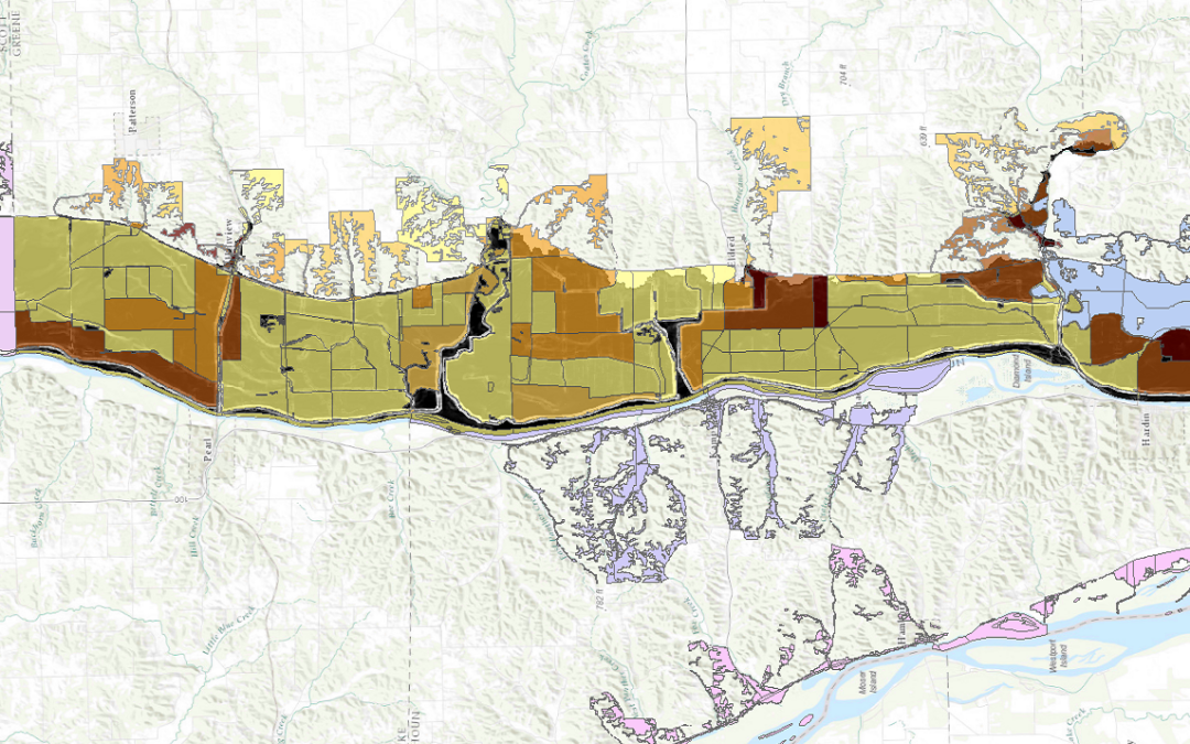
I led a team of people using FEMA’s Hazus-MH (Multi-Hazard) software to model flood risk to 2 dozen Illinois communities as part of a larger project to measure perceived vs actual risk of flood in those communities. Hazus can be finicky software, so we tried...
by Nick | Aug 19, 2016 | Maps
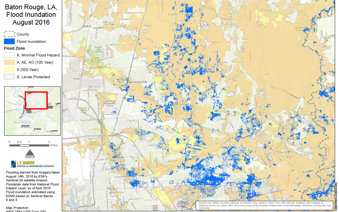
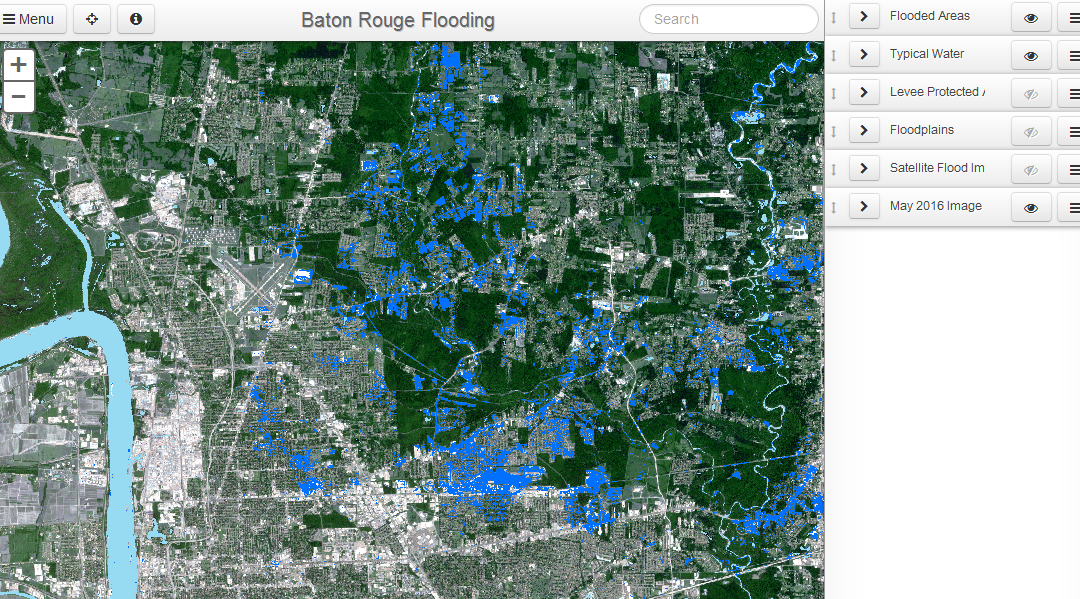
I created this static map as part of Nicholas Pinter’s Natural Hazards Mitigation Group’s analysis of flood inundation in the 2016 flooding in Baton Rouge, Louisiana. The corresponding interactive map can be found here.
by Nick | Aug 19, 2016 | Maps
In response to flooding in Baton Rouge, Louisiana as a result of storms in August 2016, we detected flooding using satellite imagery to determine the extent of inundation as it compared to mapped floodplains. The darker blue shows flood inundation on Aug. 14, 2016,...
by Nick | Jul 29, 2016 | Code, Maps, Technical
I did all of the programming, GIS, and statistical modelling for a multi-phase National Science Foundation (NSF) funded project to determine mitigation potential for flooding in small midwestern towns. The picture above is from a mockup of an interface we designed to...
