by Nick | May 8, 2024 | Maps
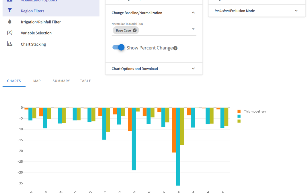
OpenAg is a hydroeconomic decision support application that builds on modeling from Josue Medellin-Azuara’s Water Systems Management Lab. Josue conceptualized a decision support application that would allow people to run numerous scenarios for agriculture across...
by Nick | Jul 20, 2020 | Maps, Talks and Presentations
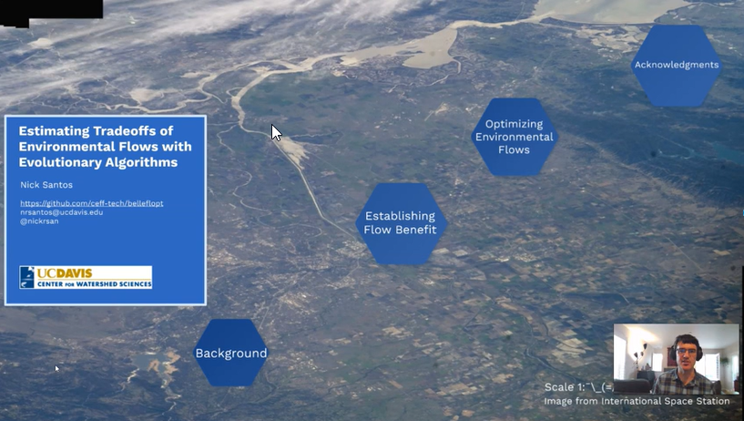
My masters thesis involved work in three areas: Theory and representation of the benefit of environmental flows in a mathematical model Downscaling ecosystem information to the stream-reach scale in order to support estimation of environmental benefit Running an...
by Nick | Sep 4, 2019 | Maps
As part of my master’s thesis, I needed stream-reach scale fish presence information as part of estimating environmental benefit within an evolutionary algorithm. I designed a simple, species-specific downscaling algorithm that translated a species presence...
by Nick | Jun 5, 2019 | Maps
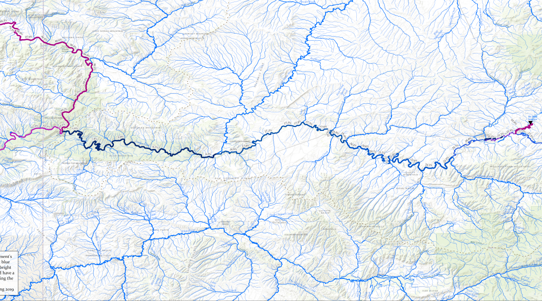
Yampa-Green-River Flow RegulationThe full 50 inch wide print layout, designed to be used in presentations that zoom in on specific locations Yampa Green Flow Regulation 8 1/2 x 11 Print LayoutA figure adapted for 8 1/2 x 11 printing and use in papers and reports For a...
by Nick | Sep 27, 2018 | Maps
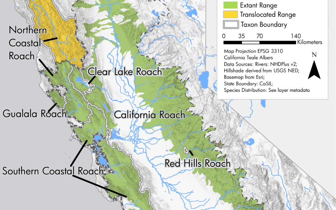
Final map for publication ranges blended onto hillshade Northern coastal roach range Clear lake roach rnage Northern roach range Southern coastal roach range Mountain whitefish range Northern California coast summer steelhead range In 2017 and 2018, I utilized our...
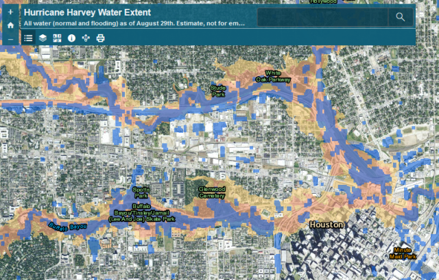
by Nick | Sep 1, 2017 | Maps
After Hurricane Harvey hit, the Natural Hazards Research Group wanted to assess the extent of the flooding as it related to mapped floodplains, as part of ongoing research into flood insurance and hazard mitigation nationwide to inform the National Flood Insurance...
