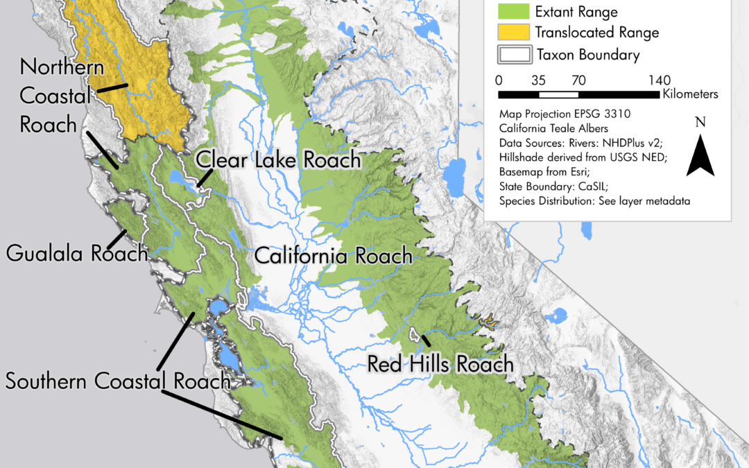
by Nick | Sep 27, 2018 | Maps
Final map for publication ranges blended onto hillshade Northern coastal roach range Clear lake roach rnage Northern roach range Southern coastal roach range Mountain whitefish range Northern California coast summer steelhead range In 2017 and 2018, I utilized our...
by Nick | Feb 2, 2017 | Code
I write a lot of spatial data analysis code using ArcGIS’s Python package, arcpy. Sometimes we need to automate map generation as part of that work, but with the split of the arcpy.mapping library between ArcMap and ArcGIS Pro, developers had to target two...
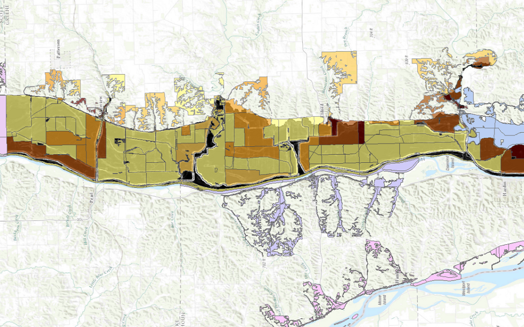
by Nick | Dec 30, 2016 | Maps
I led a team of people using FEMA’s Hazus-MH (Multi-Hazard) software to model flood risk to 2 dozen Illinois communities as part of a larger project to measure perceived vs actual risk of flood in those communities. Hazus can be finicky software, so we tried...
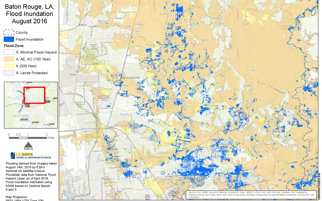
by Nick | Aug 19, 2016 | Maps
I created this static map as part of Nicholas Pinter’s Natural Hazards Mitigation Group’s analysis of flood inundation in the 2016 flooding in Baton Rouge, Louisiana. The corresponding interactive map can be found here.
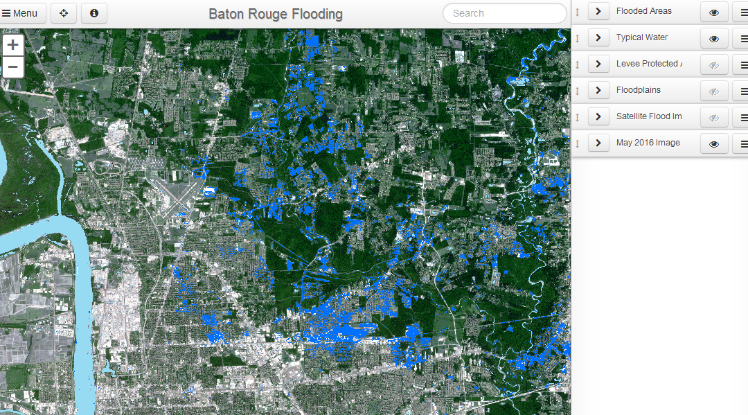
by Nick | Aug 19, 2016 | Maps
In response to flooding in Baton Rouge, Louisiana as a result of storms in August 2016, we detected flooding using satellite imagery to determine the extent of inundation as it compared to mapped floodplains. The darker blue shows flood inundation on Aug. 14, 2016,...
