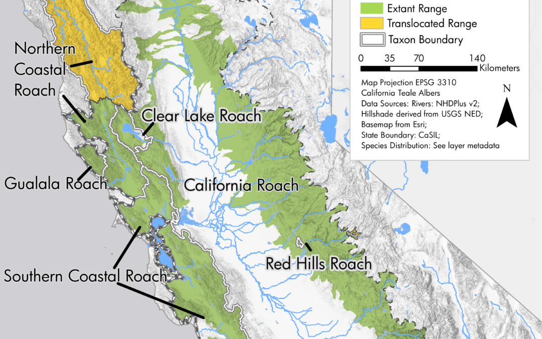
by Nick | Sep 27, 2018 | Maps
Final map for publication ranges blended onto hillshade Northern coastal roach range Clear lake roach rnage Northern roach range Southern coastal roach range Mountain whitefish range Northern California coast summer steelhead range In 2017 and 2018, I utilized our...
by Nick | Jan 22, 2018 | Code
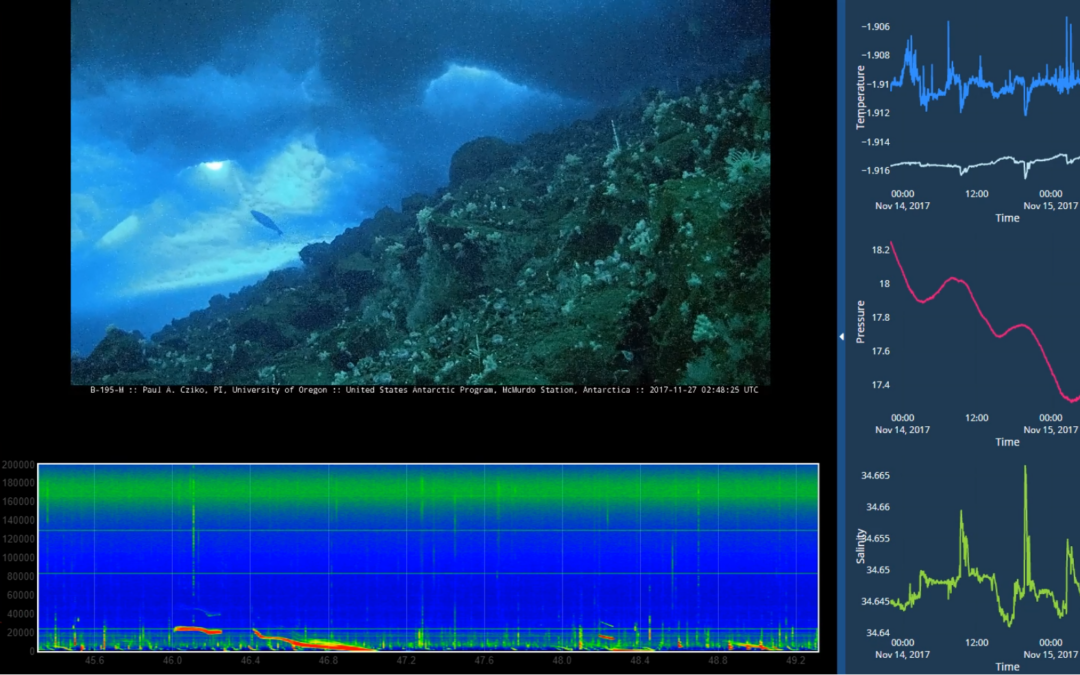
The kiosk in a normal mode The kiosk with expanded charts The kiosk with the additional videos side panel flown out The kiosk with informational text panel The kiosk on display Antarctic field work Inaccurate simulation of antarctic field work I spent October-December...
by Nick | Sep 1, 2017 | Maps
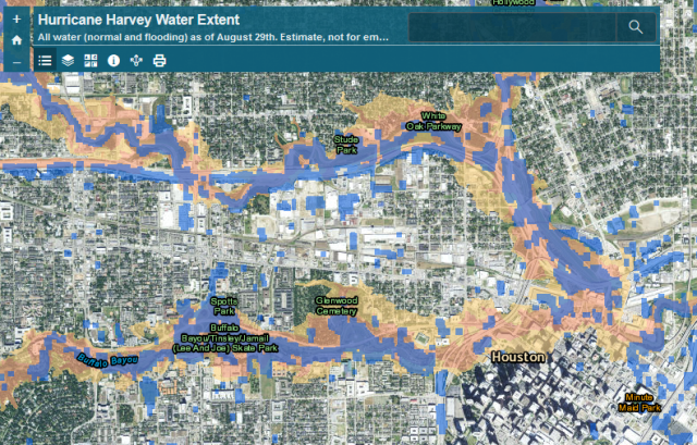
After Hurricane Harvey hit, the Natural Hazards Research Group wanted to assess the extent of the flooding as it related to mapped floodplains, as part of ongoing research into flood insurance and hazard mitigation nationwide to inform the National Flood Insurance...
by Nick | Feb 2, 2017 | Code
I write a lot of spatial data analysis code using ArcGIS’s Python package, arcpy. Sometimes we need to automate map generation as part of that work, but with the split of the arcpy.mapping library between ArcMap and ArcGIS Pro, developers had to target two...
by Nick | Jan 14, 2017 | Maps, Projects, Teaching
I receive a number of requests for additional instruction from former students who have taken one class or another. I decided to combine my tutorials for water and ecosystem analysis in ArcGIS into a single book on LeanPub, which allows for work in progress...
