by Nick | May 8, 2024 | Maps
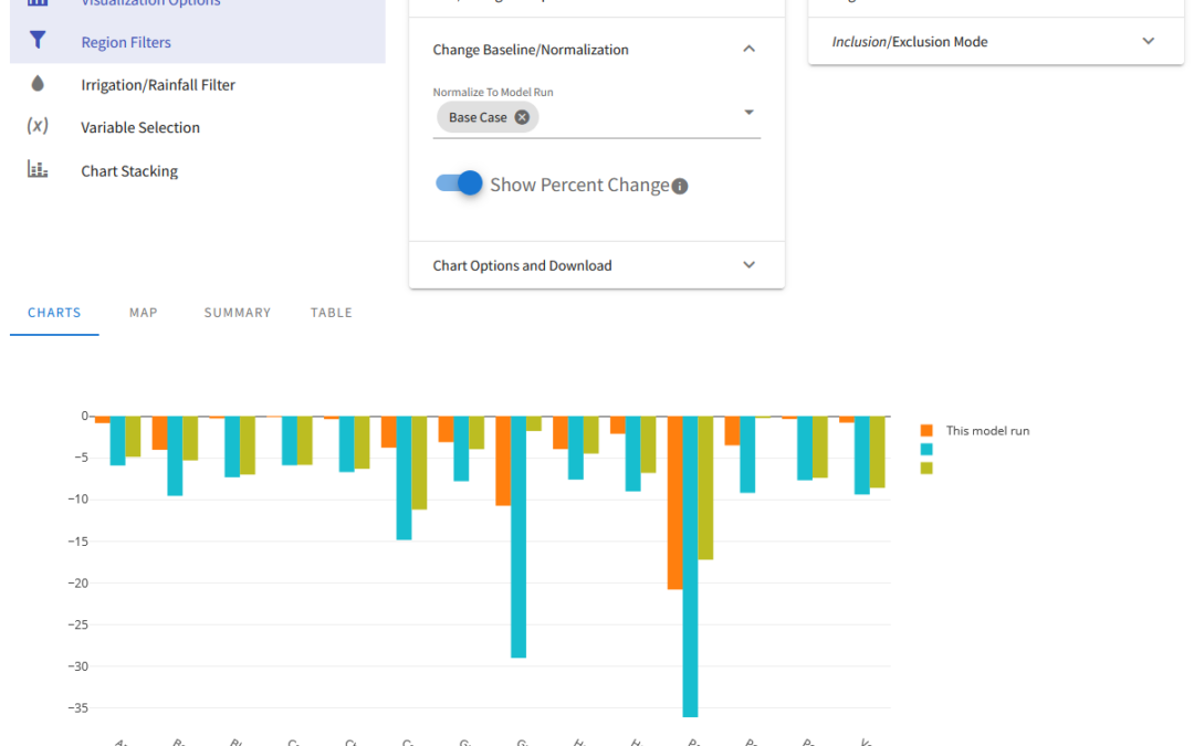
OpenAg is a hydroeconomic decision support application that builds on modeling from Josue Medellin-Azuara’s Water Systems Management Lab. Josue conceptualized a decision support application that would allow people to run numerous scenarios for agriculture across...
by Nick | Feb 27, 2015 | Code, Maps
PISCES is a set of ArcGIS tools and data for managing and analyzing the ranges of California’s 133 native fish taxa. Data is stored as a standard relational database, increasing the power over many typical GIS approaches, and allowing for a powerful mapping...
by Nick | Nov 27, 2014 | Code
ArcGIS provides powerful geoprocessing and data manipulation tools in Python, but provides no programmatic access to metadata from the language, meaning that once data is processed, information on the workflow used can’t be attached to the results. To remedy...
