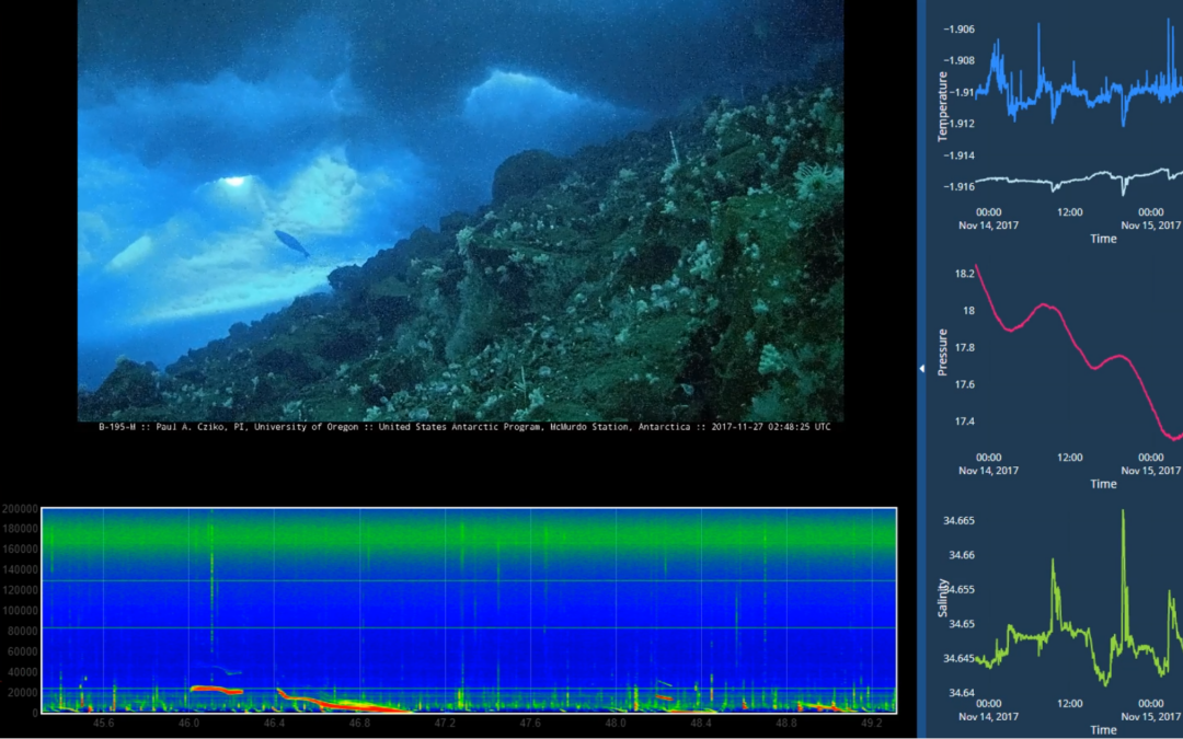
by Nick | Jan 22, 2018 | Code
The kiosk in a normal mode The kiosk with expanded charts The kiosk with the additional videos side panel flown out The kiosk with informational text panel The kiosk on display Antarctic field work Inaccurate simulation of antarctic field work I spent October-December...
by Nick | Feb 2, 2017 | Code
I write a lot of spatial data analysis code using ArcGIS’s Python package, arcpy. Sometimes we need to automate map generation as part of that work, but with the split of the arcpy.mapping library between ArcMap and ArcGIS Pro, developers had to target two...
by Nick | Jul 29, 2016 | Code, Maps, Technical
I did all of the programming, GIS, and statistical modelling for a multi-phase National Science Foundation (NSF) funded project to determine mitigation potential for flooding in small midwestern towns. The picture above is from a mockup of an interface we designed to...
by Nick | Feb 27, 2015 | Code, Maps
PISCES is a set of ArcGIS tools and data for managing and analyzing the ranges of California’s 133 native fish taxa. Data is stored as a standard relational database, increasing the power over many typical GIS approaches, and allowing for a powerful mapping...
by Nick | Nov 27, 2014 | Code
ArcGIS provides powerful geoprocessing and data manipulation tools in Python, but provides no programmatic access to metadata from the language, meaning that once data is processed, information on the workflow used can’t be attached to the results. To remedy...
